Welcome
Welcome to the story of Lot50-Kanyanyapilla (L50K). Thanks for making a virtual visit.
There’s a fair bit to see on this site but if you have any queries or if you would like to receive email updates and newsletters please contact me: gavindmalone@gmail.com. Expect four newsletters a year: summer, autumn, winter and spring.
Cheers Gavin Malone
News
Watch 6.5 Years of Tree Growth at L50K in 40 Seconds
In 2017 a time lapse camera was installed taking a photo once a week for ten years. Nick Graalman, Timelapse Adelaide, filmmaker and sponsor of the camera, has made the first 6.5 years of images into a short film, see it here., see it here.
Feet on the Fleurieu
An engaging and informative new book on the pre-colonisation story of the Fleurieu Peninsula and Kangaroo Island by Chester Schultz was launched late November 2023. Entitled Feet on the Fleurieu, Language on the Land: Aboriginal women and men, their communities, and Kangaroo Islanders. Book 1: March 1802 – January 1837, the book is about ‘Aboriginal women and men, their communities, and Kangaroo Islanders: the story of the earliest guides, explorers and interpreters around the Fleurieu Peninsula (South Australia)’.
For anyone with an interest in the bicultural history of those regions the book is a must read. Chester has kindly made the book available for free and is downloadable here (27Mb) Feet on the Fleurieu Book1-Chester Schultz Nov 23.
About L50K
L50K is a private ecological and cultural regeneration project near McLaren Vale, South Australia. A section of the Maslin Creek reed swamp is being regenerated, and a woodland re-established.
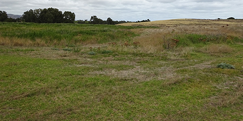
In February 2015 Gavin Malone, artist and cultural geographer, acquired the 16 ha (c.40 acres) parcel of land. Back then the land was a mix of waist-high weeds and neglected pasture, hiding two areas of sedge along drainage lines, with almost no mid or upper canopy vegetation. Geologically the undulating land is an ancient coastal foredune system providing a large sand deposit which was proposed to be mined. For this reason, there had been minimal land management for the previous 20 years or more.
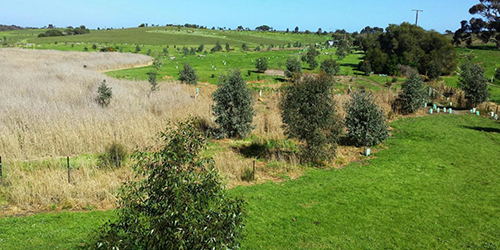
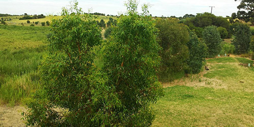
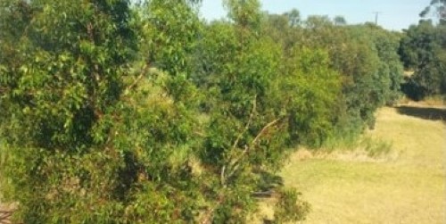
L50K now features four ecosystem types: a remnant reed swamp, remnant sedge lands, the re-generating woodland and pasture hay production. The gently undulating land slopes down about 22 metres from a sandy hilltop, 64 metres above sea level, to the Maslin Creek reed swamp. The swamp area of L50K is about 4.0 ha (c.10 acres), a small part of the greater 55 ha Maslin Creek reed swamp. The balance of the L50K land, 12.0 ha (c.30 acres), had been cleared and used for agricultural purposes for up to 170 years, agriculture likely commencing in the 1850s. The majority of this land, along with the swamp edge, is being extensively planted with indigenous species.
The land is a registered Aboriginal heritage site (SA Aboriginal Heritage Act), likely occupied for several thousand years. For this reason dual naming has been adopted. The locality name Kanyanyapilla was recorded by the John McLaren survey team in the late 1830s.
A 15-year Regeneration Plan is now eleven years in and as of 2026 about 10,000 seedlings planted, coupled with extensive weed control along with infrastructure development. The Plan is structured in 5-year phases, and the current phase is titled Consolidation and Preparation. Consolidation of all the ecological and cultural activities achieved to date and preparation for a climate change challenged world. Carbon sequestration is very much part of the Plan.
L50K is located on the corner of Pethick and Branson Roads, McLaren Vale, and is bordered on the west by the Victor Harbor Road. It is located in the centre of the Willunga Basin about 40 kilometres south of Adelaide. The Willunga Basin, circa 23,500 hectares (235 sq. km) in size, is prime viticultural and agricultural land.
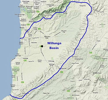 L50K (black dot), Willunga Basin, South Australia
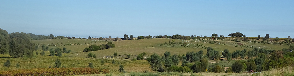
Eight Years Old, 2023
The L50K regeneration project turned eight, 15 February 2023. A quick visual review of the land follows:

2006 – August, nine years before purchase
2015 – February, soon after purchase, slashing underway

2016 – Weed control and planting underway, a wonderfully wet winter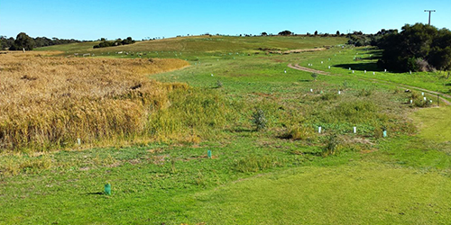
2017 – June, 10 year time lapse camera installed
2019 – September, looking good
2021 – February, looking better
2023 – February, tree growth obscuring part view, wonderful
(the time lapse camera was relocated early 2024)
About Gavin
Further information about Gavin can be found at Gavin Malone Visual Artist and Cultural Geographer.
Volunteers & Supporters
Thank you to the many who volunteer at L50K or support the project in other ways:
Fox Creek Wines
For providing wines to reward volunteers and others. Please support them.
![]()
Timelapse Adelaide
For providing two time lapse cameras to record the landscape changes over ten years. The weekly photographs will provide a valuable record of plant growth and other changes. Contact Nick Graalman from Timelapse Adelaide contact@timelapseadelaide.com about the services they provide.
Willunga Basin Links
The following groups are involved in community and conservation in the region:
Biodiversity McLaren Vale
Friends of Aldinga Scrub
Friends of Moana Sands Conservation Park
Friends of Onkaparinga Park
Friends of Willunga Basin
Willunga Basin Trail
Willunga Environment Centre
(Old) News
2021, Tim Minchin Planting Day – Short Film
Back in June 2021, Tim Minchin and his BACK tour band and crew spent a day planting at L50K as part of his carbon emissions awareness and responsibility initiative.
A short film about this has been released, see https://www.timminchin.com/greening/
2021, Another Short Film About L50K
There is a short film about L50K on the Landscape SA Hills & Fleurieu Facebook page. Posted on 22nd April, 2021 with a preview on the 20th, scroll down to those dates to view. And there’s another on Geoff Hayter & Tess Sapia’s Willunga Creek biodiversity regeneration, posted 15th April, well worth watching.
2016, Water in the Swamp
In the first week of July 2016 water flowed into the swamp for the first time in a few years. 47 mm of rain fell in 24 hrs following good rains in June. Standing water lasted for several days and then in the third week more rain and more water. And overnight on the last day of the month another 20 mm fell giving the best inflow yet, and water up to 500 mm deep in places. Rainfall for July 125 mm, 55 mm above average.
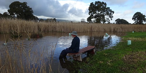
Feet needed a soak
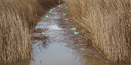
Swamp plantings get a soak, needed or not
2015, First Open Day
The first Open Day was held on Sunday 22 November, 2015. Over 150 people came along during the day to wander the land. One of the announcements on the day was the Kaurna Meyunna name for the place, Kanyanyapilla. An explanation of the name is available on the Cultural History page.
The concept of Kanyanyapilla is bigger than the land of Lot 50 and Lot 50 encompasses also the post settlement history. Bi-cultural naming, Lot 50-Kanyanyapilla, is therefore being maintained for the place and project and what better than Lot 50 to succinctly describe a relation to land subdivision and ownership from the European perspective. Either or both names can be used as appropriate.
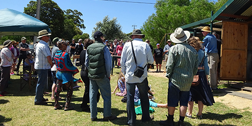
Open Day gathering, Nov.2015
